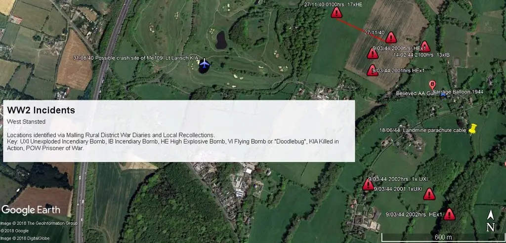
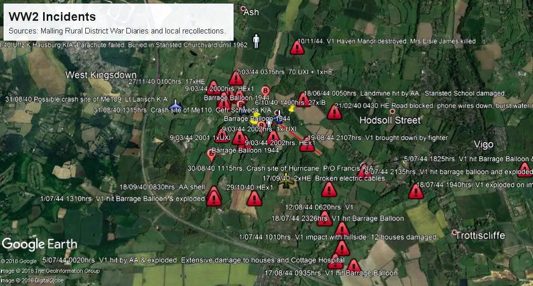
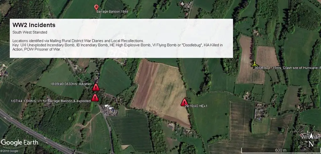
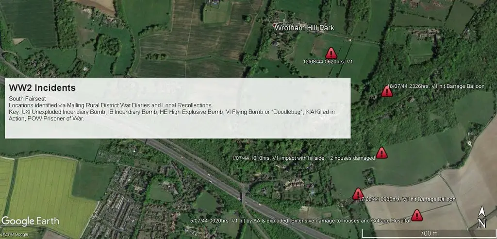
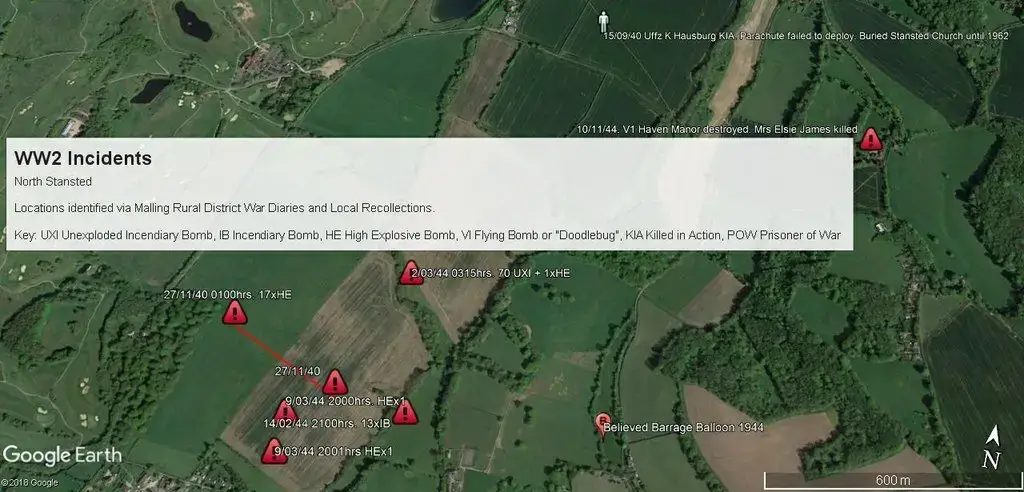
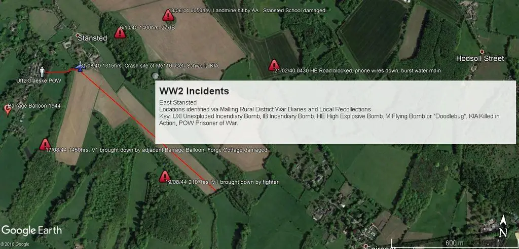
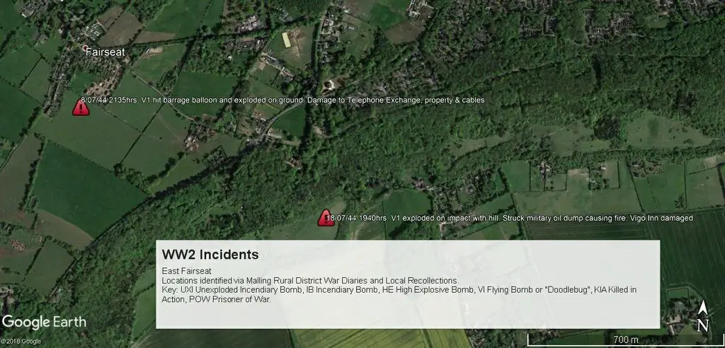
Stansted Area WW2 Incident Maps
First impressions indicate that Stansted and Fairseat were singled out as targets for enemy activity. This is misleading as many incidents occurred in neighbouring Parishes: the maps only record War Diary references to Stansted, Fairseat, Wrotham and Trottiscliffe. In most cases, there is little evidence now, as reported incidents tended to be in open fields, and the craters will have been backfilled. That said, plenty of craters still exist in the surrounding woods that went unreported.
Broadly, the maps reflect three different aspects of the War: The aircraft that crashed within days of each other at the height of the Battle of Britain, the bombs and incendiaries that were jettisoned by damaged enemy aircraft, either on their way, or on their return from bombing Docklands during the Blitz, and finally the V1’s which came down en-route to London. Some hit locally tethered Barrage Balloon cables, some were brought down by anti-aircraft guns, one was so low it actually hit the side of the hill, one was shot down by a fighter and others may have fallen short of their intended targets as a result of the contentious British Intelligence policy of using double agents to overstate the impact locations, causing the Germans to reduce the fuel load.
V1 and V2 impacts (including airbursts)
Orpington | 42 | Sevenoaks | 7 | Stansted | 4 | Luddesdowne | 2 |
Chislehurst | 37 | Wrotham | 7 | Mereworth | 3 | West Malling | 2 |
Beckenham | 35 | Gravesend | 6 | Offham | 3 | Borough Green | 1 |
Bexley | 28 | Darenth | 6 | Leybourne | 3 | East Malling | 1 |
Bromley | 26 | Eynsford | 5 | Maidstone | 3 | Heaverham | 1 |
Sidcup | 18 | Lullingstone | 5 | Platt | 3 | Knockholt | 1 |
Shoreham | 11 | Meopham | 5 | Addington | 2 | Otford | 1 |
Dartford | 10 | Plaxtol | 5 | Birling | 2 | Ryarsh | 1 |
Seal | 8 | Snodland | 4 | Dunton Green | 2 | Trottiscliffe | 1 |
Ightham | 8 | Kemsing | 4 | Fawkham | 2 | Swanley | 1 |
(Source: The V Weapons Then and Now by Winston Ramsey, Editor)
One omission from the above table is the Parish of Ash. This is because the source data does not distinguish between Ash cum Ridley and Ash near Dover. Whilst it is known that at least one V1 fell in Ash cum Ridley (that which destroyed Haven Manor on 10/11/44 killing Mrs Elsie James), the Parish falls outside of the Malling Rural District, and therefore it has not been possible to verify whether any or all of the other 4 V1 impacts occurred locally.
Similarly, the source data actually attributes a total of 5 impacts in Stansted. The 4 listed have been verified with the War Diaries, but the 5th incident (a V2 at 2355 on 21/03/45) in all probability fell at Stansted in Essex as it was the last of 11 launched that night, with all of the others falling in Essex. None of the local recollections records a rocket hitting Stansted, and by this late stage of the War, Essex, rather than Kent took the brunt of bombs falling short of London. This was because by then all of the launch sites in France had been overrun after D-Day, necessitating the weapons to be launched from Holland. Thus their flight path to London changed from North West to due West.
Equally, the source data does not differentiate between Shoreham in Kent and Shoreham by Sea in Sussex, hence some of the 11 missiles are probably incorrectly attributable to Kent. The total has been included, however, on the basis of proportionality, i.e. Kent bore a very much higher proportion of impacts than West Sussex, (hence the nickname “Doodlebug Alley”), and Shoreham has long claimed it was the most bombed village in Kent!
Finally, to put the V Weapon campaign into a local context, it is worth noting that around 9,000 V1’s and 1,000 V2’s exploded in the UK between June 1944 and March 1945 killing almost the same number of people and injuring nearly 25,000. Our locality featured at both ends of the campaign. The very first V1 to reach the UK on 13/06/44 exploded at Swanscombe at 0413hrs, and the third fell at Platt at 0506hrs, neither incurring any casualties. The last V2 to fall in the UK was at Orpington on 27/03/45 killing Mrs Ivy Millichamp.
The following images show the various local areas with overlays highlighting the locations of various world war II incidents.
Note: Please click on the images below to reveal the full size version.